|
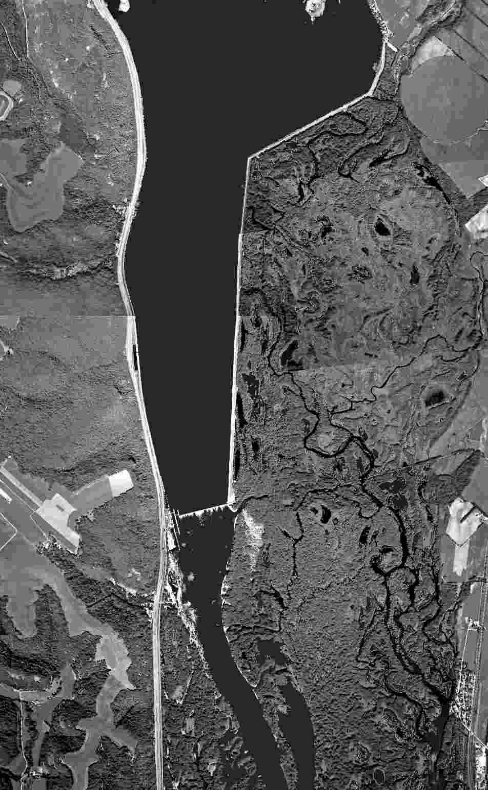
Whitman Bottoms The aerial photo below tells a revealing story about the river. The white line across the river is Lock and Dam 5, a few miles downriver from Buffalo City, Wis. The straight line extending up from the dam on the right side of the river is a three-mile-long dike. Whitman Bottoms -- a maze of channels, marshes and dry land to the right of the dike -- offers a pretty good example of what much of the Upper Mississippi river looked like before the lock-and-dam system was built in the 1930s. The big expanse of open, shallow water on the left side of the dike is typical of how much of the river looks today. So this photograph gives us a picture of the past and a picture of the present at the same time. The dike helped create the modern river on the left while it helped preserve the complex backwaters on the right. Next to the photograph is a map of the same stretch of river in 1895, nearly 40 years before the dike, lock and dam were built. The map and photo show how we have changed the twisty, complicated river into something simpler and controlled. When the old map was created the U.S. Army Corps of Engineers was following Congress' instructions to create and maintain a 4.5-foot channel on the river. To do this the Corps dredged the shallow spots and built wing dams and closing dams, which worked to direct the river's flow into the Main Channel. This increased flow helped scour out the channel and keep it open for reliable shipping. It also cut the flow of water through most backwaters.
| ||||
| ||||
|
Congress decided to build the lock-and-dam system in the 1930s in order to provide jobs during the Great Depression and to deepen the channel to nine feet. Engineers carefully picked the spot to build each lock and dam so that the dam would hold back enough water to make shallow spots upstream from the dam at least nine feet deep, in order to increase commerical shipping. Creating a nine-foot channel with the dams changed the Upper Mississippi River from Minneapolis to St. Louis into a series of artificial lakes. Islands and lowlands above each dam were permanently flooded, while islands and lowlands immediately below each dam changed little. The dike connecting Lock and Dam 5 to the Wisconsin shore is unusual, because it stretches upstream, while most dikes take a more direct route across the river. This preserved a larger expanse of backwaters, but the dike cut off the flow of water through the backwater. This, in turn, reduced the amount of oxygen in the backwater channels, especially in the winter when the shallow backwaters are covered with ice. Deep snow on the ice blocks sunlight, which kills many of the plants that create oxygen. To remedy this, pipes were installed in two places in the dike. These pipes bring oxygen-rich water from the Main Channel into the backwaters and increase the flow of water through the bottoms. The dam and dike form an effective barrier to fish trying to migrate up the river during the spring spawning season. Some wildlife managers have considered creating a "fish ladder" behind the dike that would allow fish to swim around the dam.
| ||||
| ||||
|
Backwater MazesYou can reach the Whitman Bottoms from Merrick State Park, from two public boat ramps or from the upriver end of the dike, on the south edge of Buffalo City. Reno Bottoms, across the river from Genoa, Wis., is similar to Whitman Bottoms. It, too, is behind a dike that runs several miles upstream, from Lock and Dam 8. The bottoms is a complicated maze of narrow channels, where boaters sometimes lose their way. |
You can reach the Reno Bottoms from the end of the dike in Reno, Minn.; from a road just south of the junction of highways 14 and 26; or by driving east out of New Albin, Iowa. Where to See Swamp White Oaks on the RiverPool 4, Nelson Trevino Natural Area. Pool 5, downriver from Alma, Wis., near river mile 749. Pool 5A, Whitman Bottoms. |
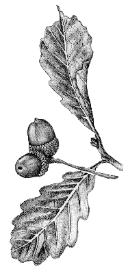
Pool 7, upriver from Lake Onalaska, near river mile 708. Pool 8, Goose Island area. Big OakA swamp white oak on Goose Island, downriver from La Crosse, Wis., is the seventh largest swamp white oak registered in Wisconsin's Champion Tree Program. Its trunk measures 133.7 inches around, the tree is 83 feet tall and its canopy is 83 feet wide.
|
![]()
For Your Information
Seven aerial photographs from the Environmental Management Technical Center, National Biological Service, were combined by Seth Urion to create the image on the upper left.
The map on the right was taken from a map created by the Mississippi River Commission in 1895. It was loaned to Big River by the Upper Mississippi Fish and Wildlife Refuge, Winona, Minn., office.
Randy Urich, forester for the Army Corps of Engineers, Mississippi River Project office in La Crescent, Minn., provided information about swamp white oaks.
A good reference on the swamp white oak is the two-volume Silvics of North America, Agriculture Handbook 654, published by the Forest Service, U.S. Department of Agriculture.
This and other River Notes are available on the Big River World Wide Web site (www.big-river.com) or from the Minnesota-Wisconsin Boundary Area Commission, 619 Second St., Hudson, WI 54016-1576; (612) 436-7131 or (715) 386-9444.
Mississippi River Notes are created by Big River (P.O. Box 204, Winona, MN 55987) for the Minnesota-Wisconsin Boundary Area Commission, with support from the McKnight Foundation.
This River Note is in the public domain. You may copy and distribute it without permission.
November 1997